
Englewood Neighbors by Block: What Each Source Adds
A block lookup works when each source is kept in its own lane. The county parcel result establishes the subject tract. GIS supplies the boundary and nearby geometry. A deed or tax record can add a parcel relationship. A voter result is an identity-matched record, not a block browse. The city’s neighborhood program describes civic geography and group contacts without publishing a household roll.
| Source | What it shows about a block | Access |
|---|---|---|
| Assessor parcel result | Situs, PIN/AIN, legal description, neighborhood code, physical parcel facts | Address, PIN, or AIN search |
| Arapahoe GIS / ArapaMAP | Adjacent boundaries, streets, aerials, jurisdictions, districts, public tracts | Address or parcel location tools |
| Recorder index | Instrument parties, easements, plats, covenants, and legal descriptions | Party, legal, date, reception, book/page filters |
| County voter lookup | Matched registration status and possible precinct or district | First name, last name, birth date, ZIP required |
| City neighborhood map | Forty civic neighborhood labels adopted in 2022 | Address finder and city map |
| Community organizations | Public group contacts and registration routes | City program or organization source |
The result is a public geography and community map, not a list of every person around an address. The source date and the layer date belong beside each block fact.
Turn On Parcels Before Naming a Block
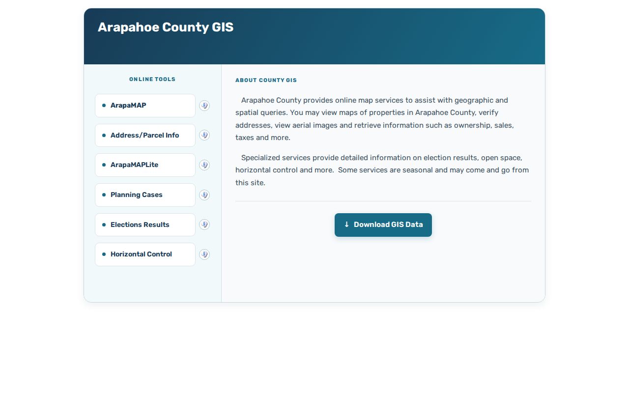
Arapahoe GIS Location Info accepts Enter Address or Enter a parcel ID or PIN. ArapaMAP provides parcel, aerial, and street layers plus measuring, locating, redlining, printing, jurisdiction, district, planning, open-space, and election-result layers. Turn on parcel boundaries and a relevant street or aerial layer before noting what lies beside the subject tract.
The viewer uses a parcel centroid. A large or multipart parcel may cross a jurisdiction. A condominium or commercial tract can have several situs addresses. A road, creek, rail corridor, common tract, park, or public building may be the apparent neighbor. Capture parcel ID or legal description, land-use class, street side, public or common status, map date, and layer name. Do not attach a private person’s name merely because a polygon touches another polygon.
The Arapahoe GIS viewer is the official map route for adjacent parcels and block geography.
Mapping an Englewood Block from One Address
The address-to-block process is a short chain. It begins with a known place and ends with a qualified list of public map facts.
- Run the address through the county parcel form and save the PIN, AIN, situs, legal description, neighborhood name, and code.
- Open GIS and place the subject parcel in the map with parcel boundaries, street, aerial, and jurisdiction layers.
- Record adjacent parcel IDs, legal descriptions, land-use classes, rights-of-way, common tracts, and public institutions by direction.
- Use the recorder for a plat, easement, covenant, or legal-description check when a boundary needs a recorded source.
- Use a city map or community source for neighborhood and group context, not for private membership.
This flow separates “beside” from “connected.” A parcel can touch another parcel without sharing an owner, household, association, or civic group. A public road can divide two tracts. A neighborhood label can cover many blocks without defining a legal boundary.
Neighborhood Names and Assessor Codes
Englewood’s city map identifies 40 neighborhoods adopted in 2022. The county assessor sample returned the neighborhood name Knollwood/Valley View Heights and numeric code 1408.00. Those labels should be displayed separately. The city name is civic geography. The county code supports assessment and sales classification. Neither one is a public list of residents or proof of association membership.
A block record can preserve the city neighborhood, assessor code, subdivision, block and lot where printed, street segment, GIS jurisdiction, precinct or district, historic map sheet, and public place. Labels can change. Record the map or election cycle and the source date. The city’s Neighborhood Map Project is the correct route for current civic boundaries; county GIS is the route for parcel geometry.
For a full named-street chain, use the Englewood street directory. The neighbor lookup stays focused on the immediate block and community layer.
Public Tracts, Rights-of-Way, and Shared Parcels
Adjacent geography often includes land that does not behave like a private parcel. A road, drainage corridor, rail line, school, park, open-space tract, or common area can sit beside a subject parcel. A shared or multipart parcel can place several structures under one assessment geometry. The GIS centroid can be far from the street frontage.
Use the assessor legal description, GIS layer, recorded plat, and city or county land-development record together. A right-of-way permit, public-works project, or subdivision plan may explain a visible boundary. City iMS and Public Works are request channels when an online view does not expose the needed project number, address, date, or status. A permit is a project clue, not a household or title record.
Precincts Are Not Englewood Neighbor Rolls
Voter results can add civic geography when a known person passes the county’s first name, last name, birth date, and ZIP match. The result may show precinct, district, officials, status, party, and an address where public. It cannot be used as a block browse. Confidential voters and Address Confidentiality Program participants may have protected information.
Precincts and districts can change. The county GIS site describes election-result layers since 2010 and certification three to four weeks after an election. Record the cycle or map date. A precinct line can cross a neighborhood, and a neighborhood can contain more than one precinct. The two geographies answer different questions.
Englewood Groups and Community Contacts
The city’s civic and neighborhood resources are the cleanest community-directory layer. They identify public contacts, registration routes, meeting or group information, and organization context. They do not publish a list of every household or member.
Neighborhood Group Leader Network
City Civic Directory
Quarterly network for current group leaders and interested residents.
Neighborhood Resources Program
Registration, recognition, communications, and group support.
Coordinator: 720-926-2154
Resident Association of Greater Englewood
Public community material and organization contact.
No private member roster located.
Other city-listed organizations include Rotary Club of Englewood, Englewood Lions Club, and the Greater Englewood Chamber of Commerce. The Chamber listing gives 3501 S Broadway #2, 303-789-4473, and info@myenglewoodchamber.org. A civic contact does not prove that members live in Englewood. It shows a public organization route.
The Neighborhood Resources Program can say whether an active group exists and can route a leader contact through the program. Registration may bring a city webpage or listing, communications, recognition, facility access, grants, signs, and other resources. These benefits describe a voluntary civic network, not a public roll of block households. Ask by neighborhood or group name, not by a private resident’s identity.
The Resident Association of Greater Englewood provides an organization-level community source for a neighbor lookup.

Historic Maps Around a Current Block
A neighborhood history can be built from the 1919 Englewood Sanborn base set, a dated directory street guide, a newspaper, a plat, and current GIS. The map may show a building footprint or use. A directory can show a household or street entry. A newspaper can date a public event or change. GIS shows the present parcel relationship. These sources should be compared, not blended.
Englewood’s South Platte and Little Dry Creek setting, Broadway, Cherrelyn, Petersburg, Orchard Place, and the Civic Center create search vocabulary for older blocks. The 1968 Cinderella City opening, 1997 closure, and 2000 CityCenter and RTD transition can explain a changed public landscape. For a private parcel, stop at block, building, legal, and source facts unless another official record answers a person question.
What an Englewood Block Search Must Leave Private
A neighbor lookup may establish parcel adjacency, public land use, a city neighborhood label, a recorded plat, or an organization contact. It should not expose a protected address, private customer record, full birth date, government identifier, or an inferred household list. The Driver’s Privacy Protection Act restricts motor-vehicle address data. Voter, vital, juvenile, sealed, suppressed, and registry records carry their own limits.
| Official source | What it can show | What it does not prove |
|---|---|---|
| GIS | Adjacent parcel geometry and public map layers | Who a neighbor is or whether a person is inside |
| Assessor | Parcel and assessment fields | Every current household member |
| Voter lookup | Matched registration fields where public | A block-wide list or protected address |
| Community group | Public organization contact | Private membership or household affiliation |
| Compiled profile | A paid summary assembled from mixed sources | A verified, dated primary record |
Lawful personal use. Englewood neighbors research is for getting oriented to a block, reconnecting, family history, and civic understanding. Do not use records to stalk, harass, intimidate, or harm anyone.
Keep the map date, layer name, parcel ID, source URL, and record type. Adjacency is enough to describe geography. It is not a reason to identify or contact a private person.
When a map question needs more proof, use the county GIS or assessor contact, a recorder appointment for a plat or easement, the City Clerk or Public Works CORA route, or the Englewood Library archive for an older map or newspaper. Phone, email, mail, and in-person channels vary by custodian. The safest request names the address, parcel, layer, date, and precise record sought.