
Englewood ZIP Codes Across the Postal City
USPS’s DMM L012 list, effective July 1, 2026, maps ENGLEWOOD to seven ZIP codes. Four fall under the 80110 preferred-city line and three under the 80111 preferred-city line in the postal list. The municipal explanation is narrower. The table preserves the postal grouping, the known local use, and the caution a ZIP code directory must carry.
| ZIP | Areas covered or label | Post office | Notes |
|---|---|---|---|
| 80110 | City area generally west of Broadway; postal service can touch nearby jurisdictions | Englewood Post Office, 915 W Lehigh Ave | Primary city candidate; verify the parcel boundary |
| 80111 | Nearby Centennial, Greenwood Village, or unincorporated areas | Facility not identified in the inspected DMM list | Postal Englewood label does not prove city jurisdiction |
| 80112 | Nearby Arapahoe or Douglas areas, Centennial, or Greenwood Village | Facility not identified in the inspected DMM list | Use USPS and GIS for the exact address |
| 80113 | City area generally east of Broadway; also appears in nearby postal contexts | Downtown Englewood Station, 3330 S Broadway | Primary city candidate; verify the municipal line |
| 80150 | Main Post Office or post-office-box use | Main Post Office service | Mailing clue, not a residential situs |
| 80151 | Annex Post Office or post-office-box use | Annex service | Mailing clue, not a residential situs |
| 80155 | USPS ENGLEWOOD grouping under 80111 | Facility and exact area not identified | Do not infer City of Englewood jurisdiction |
The Englewood ZIP code directory is therefore a postal map with a boundary warning. A complete street address remains the key to a property or person record.
80110 and 80113 in the City’s Own Explanation
The City of Englewood says 80110 generally lies west of Broadway and 80113 east of Broadway. That explanation is useful for municipal tax and service questions, but it is not a replacement for parcel geometry. The city also notes that the same postal labels may serve Sheridan and Cherry Hills Village. A ZIP code directory should show the local rule and the exception side by side.
Englewood’s Main Post Office is listed at 915 W Lehigh Ave, Englewood, CO 80110-9998, with posted weekday and Saturday service hours and 24-hour post-office-box access. Downtown Englewood Station at 3330 S Broadway uses 80113-9997. Post-office service addresses and delivery labels are useful clues. They are not proof that a person’s home or a parcel lies inside the city.
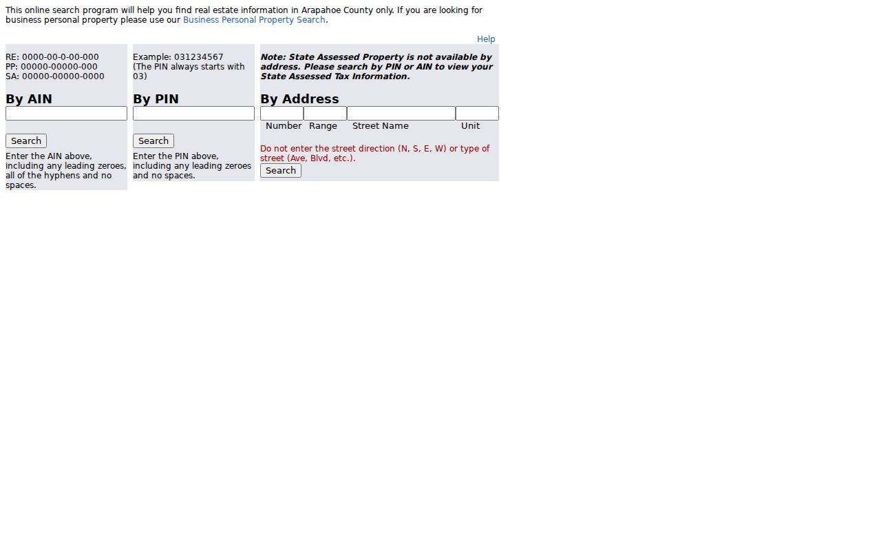
The Arapahoe parcel-search landing page is the county route for testing an address after its postal ZIP is known.
Englewood ZIP Codes at the Boundary
80111 and 80112 are the main boundary trap. They can carry an Englewood postal label while serving nearby jurisdictions, including parts of Centennial, Greenwood Village, and unincorporated areas. The city’s sales-tax explanation separates municipal jurisdiction from the postal city. A reader who sends a city request based only on the ZIP may reach the wrong custodian.
80150 and 80151 add a second trap because the research identifies them with the Main and Annex Post Office and post-office boxes. A post-office-box ZIP can establish a mailing route without identifying a residential situs. 80155 is grouped with the 80111 preferred-city line, but the inspected sources did not establish a servicing facility or exact area.
Boundary check. “Englewood, CO” on a postal label does not by itself prove City of Englewood jurisdiction. Compare USPS, assessor situs, GIS jurisdiction, and the city’s ZIP clarification.
The official Englewood ZIP clarification is the source for the city-versus-postal distinction. Historical addresses need the ZIP exactly as printed, followed by a dated modern lookup.
80150 and 80151: Post Office Box Clues
A historical directory, letter, or business filing that uses 80150 or 80151 should be read as a possible mailing clue first. Test the person or organization in the city directory, newspaper, Secretary of State filing, or city license route, then locate a parcel separately. The ZIP Code directory should not convert a post-office box into a street address.
The same caution applies to 80110-9998 and 80113-9997, which identify post-office delivery points. ZIP+4 can narrow a delivery route, but it is still not a person or parcel identifier. Record the source type, printed postal label, and lookup date.
USPS Fields for an Englewood ZIP Check
The USPS address tool can search by street address or by city and state or ZIP alternatives. A complete address is more useful than a city-only request. The result controls offer 10, 20, or 30 matches. USPS warns that a ZIP result does not confirm that a person or organization is associated with an address and recommends a unit number when a building returns several matches.
| USPS field | Format or use |
|---|---|
| Company | Optional organization line for an address search. |
| Street address | Core input; include the full number and street wording. |
| Apartment or suite | Use to narrow a multi-unit or multi-delivery-point result. |
| City and state | Postal lookup context; do not treat the city line as municipal proof. |
| Urbanization | Conditional field for address formats that use it. |
| Result count | 10, 20, or 30 result controls are available. |
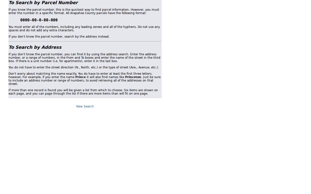
The parcel and tax portals use a different contract: number, range, street name, unit, PIN, or AIN. GIS has no ZIP input. Recorder search has no ZIP field. A ZIP code directory must state these absences so a reader does not wait for a ZIP-wide county search that the public forms do not offer.
The Arapahoe parcel-search help page documents the county’s address syntax after USPS has supplied the postal clue.
Finding Residents by ZIP Code Without a ZIP Filter
A ZIP can narrow a known identity or help sort a historical source, but it cannot produce an all-resident browse in the official Englewood systems. The safe workflow moves from postal label to exact place, then selects the record category that fits.
- Run the complete street and unit through USPS and save the returned ZIP and lookup date.
- Compare the address with the City of Englewood explanation, the county assessor situs, and GIS jurisdiction.
- Use the parcel, tax, and GIS forms by address, PIN, or AIN; do not expect them to accept ZIP alone.
- Use the voter form only when first name, last name, birth date, and ZIP are all known and the match is lawful.
- After a ZIP narrows to a street, move to the Englewood street directory for parcel and address records.
The search result should retain the postal field and the municipal result as separate facts. A matching ZIP supports delivery geography. A parcel result supports county property geography. A voter result supports a matched registration only within its own rules.
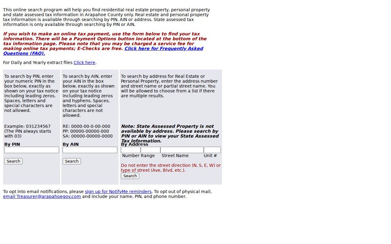
The Arapahoe tax search shows why a ZIP result must be converted into a parcel or account search.
Why Arapahoe GIS Does Not Search by ZIP
Arapahoe GIS Location Info accepts Enter Address or Enter a parcel ID or PIN. It does not provide city, state, or ZIP fields. That design reflects the map’s purpose: locate a parcel centroid and return jurisdiction, districts, parcel links, and layers. A ZIP is a delivery area, not a parcel geometry.
The assessor’s residential sales dashboard can use address plus radius, neighborhood code, property type, building type, tax year, quality grade, and remodel level. Those filters support documented sales comparisons. They do not create a ZIP directory of people. Record the tax-year window and result URL when using the dashboard.
Historical ZIP Labels Need Their Printed Form
No official ZIP split or realignment timeline was located in the inspected sources. A 1970 directory, newspaper, letter, or tax record may use a different postal convention. Preserve the printed ZIP exactly, then add a modern USPS lookup date. Do not silently replace an older label with today’s city or county assumption.
Library directories, newspapers, maps, and post-office histories can explain an old label. The city archive and local history collections are useful when a postal clue points toward Broadway, a post office, or an annexed settlement. A later GIS result should be described as a modern comparison, not as proof that the old boundary was identical.
For a historical ZIP question, save the source title, issue or publication year, page, street wording, and postal city exactly as printed. Then check the modern address through USPS and compare the current assessor situs with the county map. A library or archive appointment can help when the clue is on microfilm, in an annual, or in a local map rather than online. The City Finance or Clerk office can explain a current jurisdiction question, while USPS handles postal operations. This chain keeps a historical postal label useful without turning it into a guessed city boundary.
The Englewood Post Office lists 303-806-8863 for its service route. City Finance lists 303-762-2300 for municipal questions. County GIS and Assessor contacts are the right phone or in-person fallback when an address cannot be located online. USPS operational questions follow USPS support; a city boundary or record request follows the City Clerk or county custodian. Library, archive, mail, and appointment channels are valuable when the clue is historical.
Englewood ZIP Code Directory Limits
ZIP Code, ZIP+4, carrier route, post-office station, and municipal boundary are related but distinct. A ZIP code directory can organize postal coverage. It cannot reveal a private household list, replace a parcel search, or override protected voter and vital-record rules. Nearby jurisdictions may share the Englewood preferred-city name, and a post-office box can lack a residential situs.
Use the full chain. ZIP label → complete street and unit → assessor situs → GIS jurisdiction → record-specific custodian. Each arrow answers a different question.
The most reliable ZIP result carries the address, unit, postal ZIP, municipal jurisdiction, county parcel identifier, source URL, and observed date. That is enough to route the next record search without treating postal geography as personal identity.